Monday, June 30, 2008

Siem Reap - Views from Angkor Wat

Angkor Wat is constructed during Early to Mid 12th Century AD under King Suryavarman II with Hinduism influence. Angkor Wat is visually, architecturally and artistically breathtaking. It consists of a massive 3-tiered pyramid crowned by 5 lotus-like towers standing at 65m.

Suryavarman II constructed Angkor Wat in the form of a massive "temple- mountain" dedicated to the Hindu god, Vishnu. Although it served as his state temple, the uncommon westward orientation led others to suggest that it was constructed as Suryavarman II's funeral temple.

Angkor Wat is surrounded by a moat and an 1300m by 1500m external wall. The size of the temple itself is a square km which consists of 3 levels surmounted by a central tower.

Angkor Wat 3-tiered pyramid

Angkor Wat VIII

Angkor Wat VII

Angkor Wat VI

Angkor Wat V

Angkor Wat IV

Angkor Wat III

Angkor Wat II

Angkor Wat I

Saturday, June 28, 2008

Things to note for visiting Siem Reap, Angkor Wat

One thing is to note that in Siem Reap, you must buy an admission pass to visit the temples and sites in the Angkor Archaeological Park. As you can see in the photo, passes are sold in 1 day, 3 days or 7 days blocks that must be used on consecutive days. One day is only enough just to see the highlights of the most famous temples while seven days pass allows you to explore all the temples and visit many minor structures.

Another necessary thing to have is a passport-sized photo when purchasing the passes although free photo taking is provided. This can take up quite some time during peak hours.

It is a must to always carry your pass around and take care not to lose it as it will be checked upon each park entry and major temples.


Angkor Archaeological Park Ticketing

Angkor Archaeological Park Pass

A sample of a 1 day pass.

Saturday, June 21, 2008

Life in Cambodia, Siem Reap, Tonle Sap Lake

Description on the life in Tonle Sap Lake in Siem Reap, Cambodia...

Tonle Sap Lake is the largest freshwater floodplain lake in South East Asia, or rather in the world, and is an ecological hotspot that was classified as a UNESCO biosphere in 1997.

The most amazing thing about this lake is that during the monsoon season in October, Tonle Sap River, which connects the lake to Mekong River, reverses its flow. Water is back flowed from the Mekong into the lake, increasing its size from 3,000 sq km to 12,000 sq km, with the depth increasing from 1m to 14m, flooding nearby fields and forests, which provides a prefect breeding ground for fishes. More than 400 species of fishes have been identified, including many species of mammals and reptiles.

The area is important to the economy of Cambodia as its fisheries provide 80% of the protein consumed with the country.

There are more than 1,000,000 inhabitants (2001) live mainly in the buffer and transition areas with about sixty floating villages located on the lake and lake edges in the buffer zone. Fishing is the main activity but the fertile, flood plain is also used to produce rice and vegetables.

Reference :

One of the houses in the floating village at the edge of the lake, Chong Khneas, which is the closest and most accessible from Siem Reap.While Chong Khneas is considered to be over-touristed, interestingly it is more scenic and pristine as compared to the floating villages further down the lake.

Living in Tonle Sap Lake

Life in Tonle Sap Lake

The girl in pink, clinging onto the boat fetching tourists, hop over from the boat in the photo above while both boats were moving. She is selling can drinks to tourists onboard the boat.

Life in Tonle Sap Lake II

Life in Tonle Sap Lake III

A girl on the bucket begging for money from tourists, with a small cup on her right hand to scoop out excess water in her bucket.

Life in Tonle Sap Lake IV

A floating school (Chong Khneas Elementary School) play area.

Life in Tonle Sap Lake VI

School children rowing a boat to school.

Life in Tonle Sap Lake V

A typical day in the floating villages.
Wednesday, June 18, 2008

Esplanade and the Merlion

There are some of my earlier shots when I was starting to learn photography in the mid of last year.

Esplanade

Merlion

Monday, June 9, 2008

Singapore CBD - View from 2 locations

DSCF2473

DSCF2474

The above two photos offer the view of Singapore CBD from Mount Faber while the following photos are taken from Esplanade. The following 3 photos show the different time during sunset with the earliest taken photos listed first with the most beautiful sunset sky drop in the final photo.

DSCF0982

DSCF0987

DSCF0999

Friday, June 6, 2008

The Southern Ridges - Henderson Waves

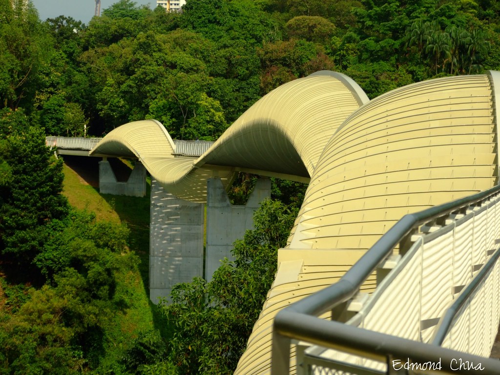
This is the newly opened 9 Km network of trails, bridges and walkways linking up the parks called The Southern Ridges. The photos are taken at Henderson Waves.


Some facts on Henderson Waves :
Wave-shaped bridge linking Mount Faber to Telok Blangah Hill Park spanning 274m across.
Singapore's highest pedestrian bridge.
Lit from 7pm to 2am daily.


Road to Mount Faber

Wow! 76.38m above sea level

Henderson Sinc Waves?

Part Henderson Waves

Symmetric III

Henderson Waves

Up in the sky?

Symmetric II

Symmetric

Thursday, June 5, 2008

Introduction

Hi all this will be my introduction posting on the photos I have taken. Basically I will be sharing photographs taken by me.